Silvan Dam Pub Trail
Silvan Dam Pub Trail linking Yarra Valley to Gippsland area.
This itinerary focuses on travellers exploring the mid-eastern region of Victoria on the approaches to Melbourne, and offers a great bypass to avoid inner suburban traffic. It provides access to two significant bases for further exploring the attractions of this region. The purposes of this trail are to:
- allow the rest of the Mount Dandenong area to be seen
- avoid suburban traffic
- identify Lilydale and Berwick as tourist pivot points
The trail notes assume you are travelling north from Berwick through to Lilydale, but simply reverse the sequence if travelling the other way. Going from south to north, is easier for access to many of the spots mentioned in this trail
Mt Dandenong lies 40kms dead east of Melbourne, and is almost the tail end of the Great Dividing Range, standing at 2066ft. This range separates the South Gippsland area (towards Bass Straight) from the Yarra Valley (winery area). Silvan Dam lies on the eastern slope of Mt Dandenong, and its road access forms a beaut link south from Berwick (on the Prince's Highway) to Lilydale, going north, which is the entracnce to three major tourist routes to the north-east.
Visitors to Victoria travelling towards the capital, Melbourne, coming down the NSW coastline and along Prince's Highway, or even further south, along the Bass Highway or South Gippsland Highway eventually pass close to Berwick.
Travelling any further towards Melbourne, you meet the conjestion of the suburbs and busy freeways - but that can be avoided if you reeally want to explore the eastern regions before travelling to the western side of Melbourne.
Similarly, travellers approaching Melbourne from the North West, say down the Hume Highway from Albury/Wodonga, or down from Shepparton through Seymour, can also consider coming into Lilydale via Yea and Yarra Glen. Again, Lilydale which lies on the edge of the main surburban outskirts of Melbourne, is a great base for exploring the North-East and eastern areas: wineries, bush, the entrance to the High Country beyond.
Silvan Dam happens to fall in the middle of this bypass along the backside of Mt Dandenong, and following this itnerary you will get to see about 30% of what the Mt Dandenong area has to offer. Refer to our adjoining Pub Trail called: "The Dandenongs" which links in with the "Silvan Dam" trail outlined here. Combined, we have set out two routes that let you see the entire region of the mountain.
I will admit that this area has significance for me personally, as it is an area I have lived in all my life, and I've spent many a time helping newcomers to the area, enjoy what is on offer - and I am confident that readers too will find this particular link, useful for establishing a great resting place for touring nearby attractions - and some mighty fine pubs in the area!
Happy Pub-Trailing!
Gaz
Silvan Dam Pub Trail Location Map
Berwick
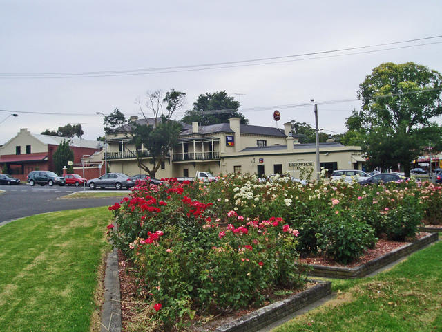
Berwick. Southern entrance to the the Silvan Dam bypass.
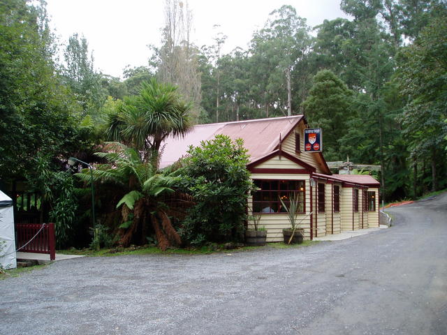
The original Prince's Highway travels right through the busy town of Berwick, and on the corner of Clyde St at the bottom of the hill in the town, is the Berwick Inn. There is plenty of on-street parking on the North-West corner if you are 'vaning. Stop and smell the roses, stretch your legs in the town, and get ready for the trip via Silvan Dam to Lilydale from here.
If travelling on the Prince's Freeway, take the Clyde St exit north to the middle of Berwick.
To: Berwick
Via Road: Prince's Hwy (not Freeway!)
Local Pubs: The Berwick Inn
Accommodation: No
Gaz's spot: Enjoying an ale around the open fire in the cosy bar of the Berwick Inn
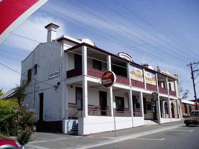
The Berwick Inn
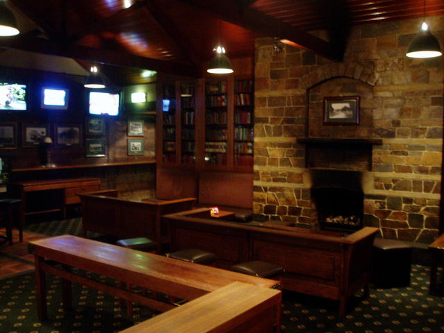
A cosy corner for an ale, at the Berwick Inn
 |
Berwick Inn »The Berwick Inn |
Beaconsfield
From: Berwick To: Beaconsfield
Direction: continue (East)
Via Road: Prince's Hwy
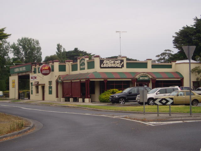
Local Pubs: Central Hotel
Accommodation: No
From: Beaconsfield To: Beaconsfield
Direction: turn left (north)
Via Road: Beaconsfield-Emerald Rd
Local Pubs: Cardinia Park Hotel (The 'Cardi')
Accommodation: No
 |
Cardinia Park Hotel »The Cardi hotel(Cardinia Park Hotel) 200 Emerald Rd |
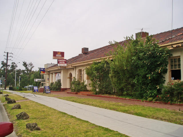 |
Central Hotel »The Central Hotel 1 Princes Highway, |
Upper Beaconsfield
From: Beaconsfield To: Upper Beaconsfield
Direction: turn left (north)
Via Road: divert into Stoney Creek Rd
Attractions: beacon Hills Country Golf Course. Views to the south east of Cardinia Dam
Local Pubs: Pine Grove Hotel
Accommodation: No
Gaz's spot: Overlooking the grapevines int he adjoining winery
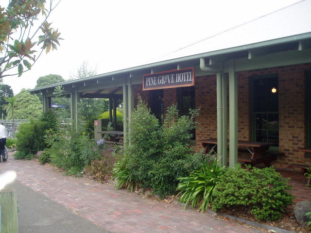 |
Pine Grove Hotel »Pine Grove Hotel Stoney Creek Road, |
Clematis
The next stage is a bit windy, and the road changes name many times - but stay with the main bitumen and follow the trail notes below.
You're skirting around the southern reaches of Cardinia Dam which is a major water supply for the Melbourne Metropolitan area.
After you've turned into Wellington Rd and start heading to Clematis (follow the signs to Emerald which is after Clematis), you'll start to see part of the wall structure of the dam on your right.
Two things worth exploring here:
- Bob's reserve on the left of the road, is a top spot for sailing/boating and picnics
- The dam wall can be inspected by taking the entrance on the right of the highway.
After checking these out, push onto Clematis where Wellington Rd comes to its end. The next pub is on the corner!
If you're lucky enough to spot it, the Puffing Billy steam train passes right through the backyard of this pub - so its a top balcony spot for an ale and seeing the train chuff through the adjacent hills, as it winds its way from Emerald Lake down to Belgrave.
From: Upper Beaconsfield To: Clematis
Direction: follow Stoney Creek Rd to a sharp left where it becomes Albert Rd; continue ahead asn it becomes Manestar Rd; and even further ahead as it becomes Boundary Rd. Turn Right into Belgrave-Emerald Rd (North) to the end where you turn right (east) into Wellington Rd
Via Road: Wellington Rd
Attractions: Cardinia Dam, Bob's Park
Local Pubs: Paradise Creek Hotel
Accommodation: No
Gaz's spot: Checking out the engineering of the dam
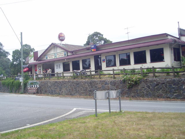 |
Paradise Valley Hotel »249 Belgrave-Gembrook Road, |
Gembrook
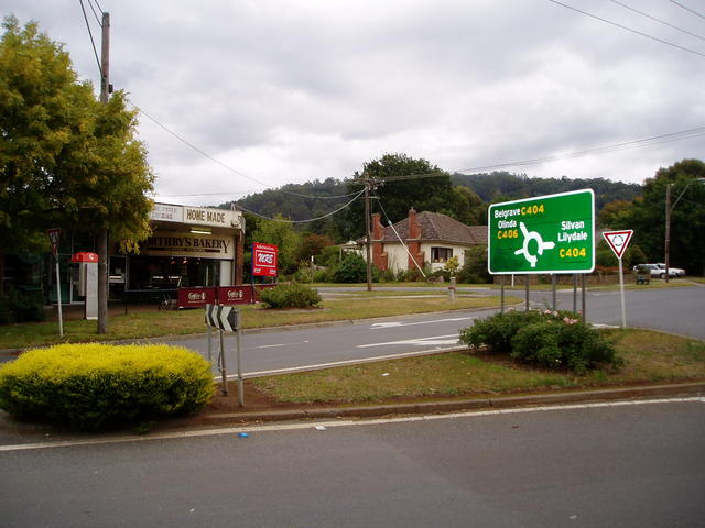
Deviation through Emerald to Gembrook
Just while you're in this area, this is a good opportunity to consider a sideline trip east through Emerald to Gembrook and back to Clematis, to keep back on track to Belgrave on this Pub Trail.
Puffing Billy runs all the way through to Gembrook, and it is a treat to follow the rail line to Emerald, stroll the town and the rail station there. Then head on down to the end of the train line at Gembrook.
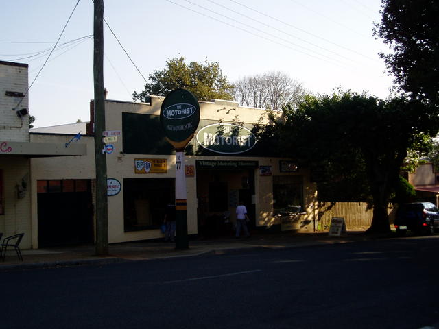
The Motorist - museum and antiques.
And for motoring enthusiasts, Gembrook has an interesting Motor Museum and antiques display including refreshments in the middle of the town (open Wed-Sun 11-4, and other times in summer seasons). A lot of local information about the town is available on the town's website.
So take run into Gembrook, and park at the station there - or even consider a run down and back using the Puffing Billy steam train. Partial trips are possible.
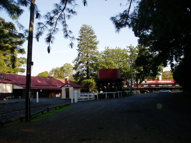
View of the historic Ranges Hotel with the Gembrook railway staion for Puffing Billy steam train in the foreground
 |
Ranges Hotel (The) »The Ranges hotel - conveniently positioned right at the end of the Puffing Billy train line - top spot to pop in for a meal after a ride down into the area |
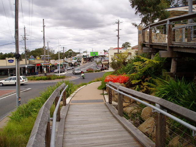
Belgrave
From: Clematis To: Belgrave
Direction: left at the end of Wellington Rd
Via Road: Belgrave-Gembrook Rd
Attractions: Menzies Creek rail memorabilia, Puffing Billy steam train line
Local Pubs: Bell Tavern and Micawber Tavern
Accommodation: No
Gaz's spot: Sitting under the trestle bridge watching Puffing Billy steam train cross the bridge (between Selby and Belgrave)
Travelling down towards Belgrave, you will follow and sometimes cross the narrow guage railway track of Puffing Billy steam train - an iconic tourist attraction of Melbourne.
Passing through Selby you come to the Fire Station on the left, and if you are just in a car, it is possible to drive down to the end of Greenwell Rd to get a great view of the historic Trestle bridge. U-turn and return to Belgrave-Gembrook rd to continue into Belgrave.
Puffing Billy runs from Belgrave through Selby, Menzies Creek, Clematis to Emerald Lake beyond Emerald township. The extended ride takes travellers further east to Gembrook.
Belgrave station is the end of the electric train line out of Melbourne, and adjacent, is the Puffing Billy rail station. Take a stroll through the town, enjoy a meal at the local cafes or pubs.
The town also boasts a unique outdoor picture theatre at the Cameo Theatre at the western end of the town.
**CARAVANNERS: Please Note: **
Belgrave is a very tight thin set of streets through the town - not recommended for long towed vehicles. There is not very much parking around for car/trailer combinations. Once you reach the roundabout at the top of the town just past the bridge that has the two rail stations either side, you are pretty much committed to turning right and heading way out of town with few places to turn until you get 4kms up the road to Kallista. Turning left through the town also takes you way down Burwood Rd. There's no real 'round-the-block' scenario you can do. The main railway carpark may have a couple of drive through spots way up the back, but don't count on it.
No worries if you are just travelling without a trailer.
Kallista
From: Belgrave To: Kallista
Direction: North
Via Road: Monbulk Rd
Attractions: Sherbrooke Forest, Grants Reserve
Local Pubs: Micawbers Tavern
Accommodation: No
Gaz's spot: Walks down to Sherbrooke Falls
Head out of Belgrave to the eastern end where you first arrived from Clematis. But now push on up the road to the north-east up Monbulk Rd towards Monbulk, via Kallista.
On the way, you'll wind around for 1-2kms towards the start of Sherbrooke Forest, and pass some craft/art shops you may want to visit.
As you sweep around the last bend before reaching Sherbrooke Forest, keep an eye out for the Micawber Tavern on your left which has a brilliant bar atmosphere.
The roundabout at the entrance to Kallista, is a point where our two local Pub Trails cross.
At this roundabout, you cross the road that comes up from The Patch on your right, and goes left up to Sherbrooke. Refer to "The Dandenongs" Pub Trail that takes you up and over Mt Dandenong, which compliments this Silvan Dam trail.
We recommend that both trails be considered separately to cover the entire region, but Kallista is the mid-point that lets you consider a figure-8 journey taking in aspects of both our trails if you prefer.
So, if you're pushing on to Monbulk (per this Silvan Trail), then either proceed straight through the roundabout through Kallista township and down to Monbulk. Or, after you check out the small village of Kallista, we'd recommend you consider a small deviation between here and Monbulk, by turning right at this initial roundabout and going down via The Patch.
Belgrave township looking west from the roundabout at the top of town. Railway to Melbourne is left over the bridge (and then a right), and Puffing Billy rail station is further to the left over the same bridge.
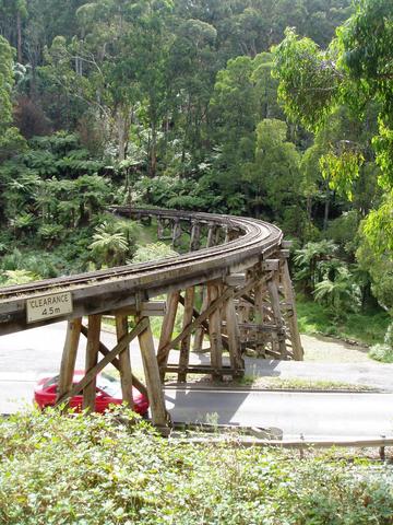
Trestle bridge, on Belgrave-Gembrook Rd, about 0.5km west of the Selby fire station. (This view is from the end of Greenwood road, a private, gravel dead-end street)
 |
Bell Tavern »Right in the middle of Belgrave township on the high side on the bend. 1645 Burwood Highway, |
 |
Micawber Tavern »Corner:Gully Cres and Monbulk Rd |
Monbulk
From: Kallista To: Monbulk via The Patch
Direction: right
Via Road: Kallista-Emerald Rd, straight on at "Cook's Corner cafe", past the majestic views until you turn left into The Patch Rd (past general store), bear right at O'Connors Rd, cross Camms Rd, straight into Masches Rd (name change), and merge back onto Monbulk Rd (see pic).
Attractions: Panoramic views to Mt Donna Buang,
Gaz's spot: Chestnut sales from private sellers in Camm's Rd.
Entering Monbulk coming down from Kallista, you reach a roundabout just short of the western end of the town.
You will be turning left at this roundabout to head out towards Mt Evelyn passing the Silvan Dam on your left as you go.
But first, drop in for a stroll, coffee or nibble in the town, and come back to this roundabout.
From: Kallista To: Monbulk
Direction: north-east
Via Road: Monbulk Rd
Silvan Dam
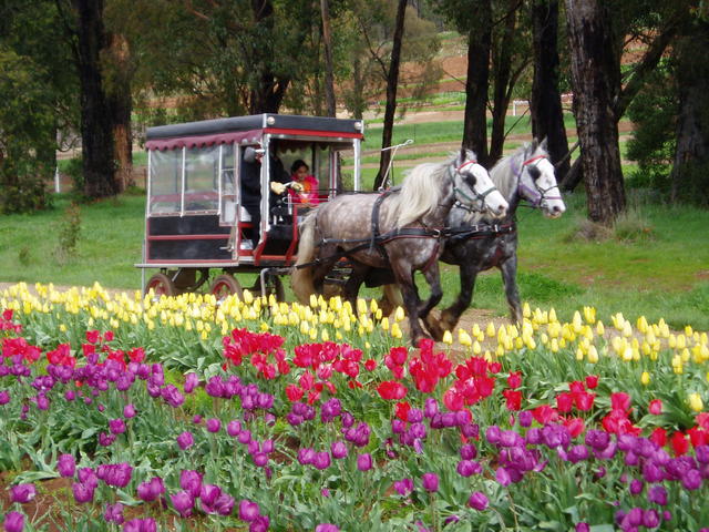
This area is renowned for its roses, tulips, berries, potatoes and a variety of other horticultural and farming produce.
Keep an eye out for Tesselaar's Tulip farm along this route not far from the midpoint of the Silvan Dam that has an entrance on the left.
Take a spin down to the dam, where there is an abundance of BBQ and picnic facilities, and inspect this picturesque dam.
From: Monbulk To: Silvan
Direction: North-east
Via Road: Monbulk Rd
Attractions: Silvan Dam, and Tesselaar's Tulip Farm
Gaz's spot: The great rose nurseries and fruit/vege stalls along the route.
Return from the Dam, back onto the same road for pushing on towards Mt Evelyn and Lilydale.
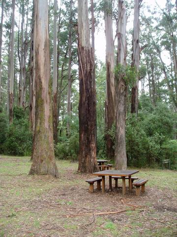
Picnic area in Grant's Reserve, on the right side of Monbulk Rd, just before reaching the township of Kallista. Great spot to feed birds, have a picnic, or walk to the Sherbrooke Falls.
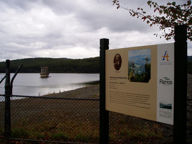
Silvan Dam wall, showing 45m concrete tower - built in 1926-1928.
Mt Evelyn
Travel into Mt Evelyn which has a huge roundabout at the top of the town, where you turn left into York Rd to decend down the side of the mountain down to Swansea Rd.
As you pass down York Rd through the town, you will see parts of the Warburton Rail Trail (now a walking track). More about this rail (walking) trail is mentioned in our Warburton Pub Trail which runs out east not far from the Mt Evelyn township - which we suggest is taken from Lilydale.
So you'll pickup some of the attractions that are nearby Mt Evelyn, by referring to that separate trail. But we would make mention of Mont De Lancey which can be reached from Mt Evelyn by slipping down Clegg Rd which was at the set of lights about 1km before you reached the roundabout at the top of Mt Evelyn. See the Warburton Trail for more details.
Back to our journey to Lilydale.....
Push on winding down the steep decent along York Rd till you arrive at the York on Lilydale international hotel complex at the end of York Rd.
From: Silvan To: Mt Evelyn
Direction: North then west
Via Road: Monbulk Rd, left into York Rd at the top of Mt Evelyn. Proceed to the western end of York Rd to the end, at Swansea Rd.
Attractions: Warburton (Rail) Trail - walking trail.
Local Pubs: York on Lilydale
Accommodation: Yes: 40 Spas. resort.
Gaz's spot: exploring the steep section of the Warburton (Rail) trail and interesting shops adjacent the roundabout at the top of Mt Evelyn township.
You'll head north along Swansea Rd to reach Lilydale, but stop off at the York on Lilydale to check out its many function rooms and facilities.

Mt Evelyn township is adjacent the Warburton Rail trail walking track
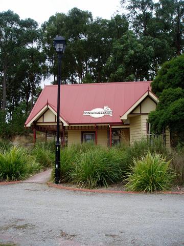
Mt Evelyn Community Link centre with bbq and picnic facilities
 |
York On Lilydale »At the foot of York Rd, 2-3 kms down from Mt Evelyn, and on the corner of Swansea Rd which leads you into Lilydale township about 4kms north. Cnr York and Swansea Roads |
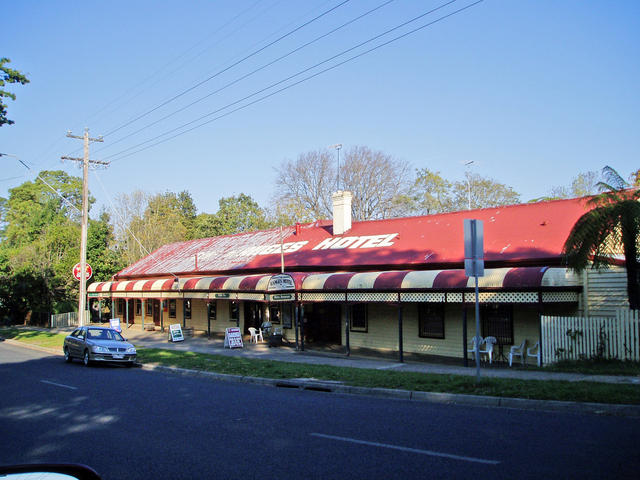
Lilydale
Well, you've reached the destination of this trail: Lilydale.
Refer to the Warburton Pub Trail for details of the pubs in Lilydale.
Consider making Lilydale your base for doing a number of other trails in the area:
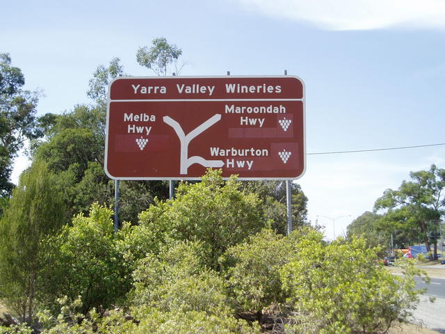
- wineries in the Yarra Valley
- follow the Yarra River to its source up through the Warburton Trail
- local towns like Yarra Glen and Healesville - and the loop past the Yarra Glen racecourse via the picturesque road through Tarrawarra
- take a joy flight or glider ride from Lilydale Airport
- consider an early morning balloon ride over the Yarra Valley wineries
- pop over to nearby Coldstream to check out the lastest boutique brewery
- take a suburban train ride into Melbourne for the day and do our one-day Melbourne Pub trail
- head off and explore The Dandenongs trail
Ah! This region has just so much to offer.... You'll need a few more days, that's for sure.
Time for an ale!
Happy Pub trailing in Victoria!
Gaz
Gary Pope
0408994799
Introduction: What are Pub Trails?
Want more local trails?
refer to: An Overview of Pub Trails in Victoria

Tesselaar's Tulip Farm during the annual festival around September each year.
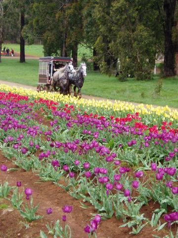
Enjoying a horse and cart tour of Tesselaar's Tulip Farm.
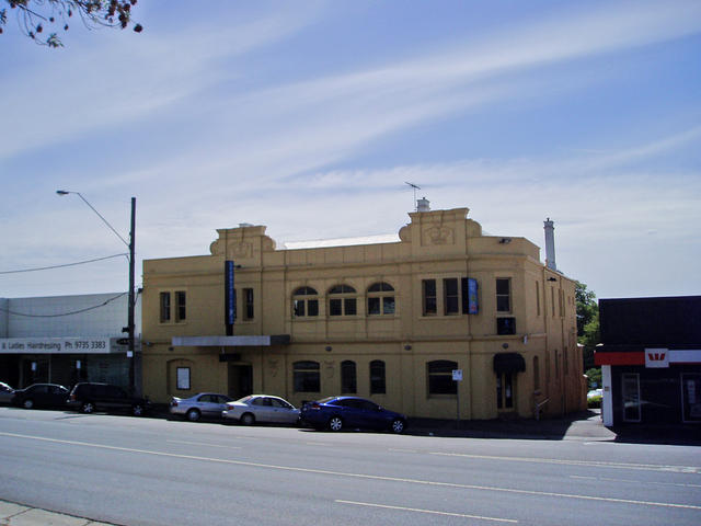 |
Crown Hotel »273 Main St |
 |
International Hotel »471 Maroondah Hwy |
 |
Lilydale Hotel »292-300 Main St |
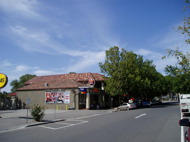 |
Olinda Creek Hotel »161 Main Street, |